China Focus: China develops complete BDS industrial chain
China Focus: China develops complete BDS industrial chainBEIJING, Dec. 22 (Xinhua) -- China has developed a complete industrial chain of…
0 Comments
January 8, 2022


China Focus: China develops complete BDS industrial chainBEIJING, Dec. 22 (Xinhua) -- China has developed a complete industrial chain of…
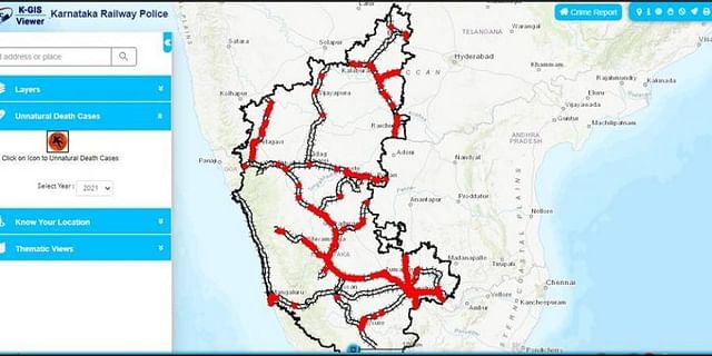
Railway cops use novel remote sensing app to record unnatural deaths on Karnataka rail tracksIt is now being utilised by…

UW students use remote sensing to solve family land issuesTwo University of Wyoming agroecology majors are using free satellite images…
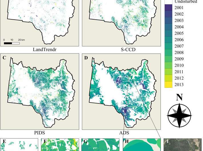
Fine-tuning remote sensing to protect forests from the spread of dangerous insect infestationsInvasive insects, fungi, or other pathogens can sweep…
HPC helps scientists extract data from satellite and drone imageryOak Ridge National Laboratory (ORNL) researchers are using machine learning and…
UMass Amherst-led Remote Sensing Work Wins $4.5 million NASA Contract | UMass AmherstAMHERST, Mass. – A multi-institutional team led by…
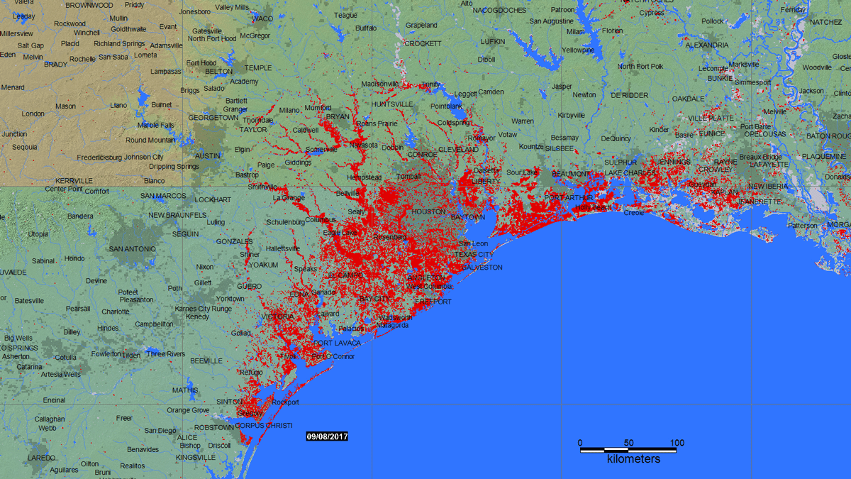
Remote Sensing Could Predict Well Water Quality After Floods - EosAfter a flood, most people rely on officials to test…
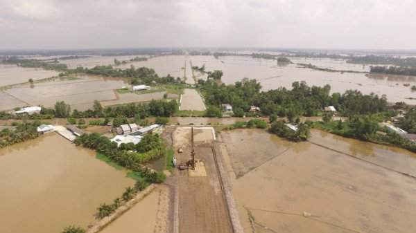
Remote sensing applied to monitor erosion in Mekong DeltaA delegation of the Ministry of Natural Resources and Environment (MoNRE) led…
Aerial vs. Satellite: How to Choose the Best Imagery Type Remote sensing methods are methods of studying the Earth and…
University of Guam awarded $715K for aquifer research using NASA technologyThis November, University of Guam will start a $715,014 project…