Engineers have ever more demands on their expertise and must bring with them diverse stakeholders and supply chains to achieve great outcomes. But technology can feel to some like an added complication, not a solution. So, how are current advances making it easier for engineers to do what they do best?
There can be no denying that civil engineering has grown more complex in recent years. Supply chains have extended, specialisms have proliferated and requirements for lower carbon, better biodiversity outcomes and futureproofing for changing uses, all play their part.
As a result, digital technology has become vital, enabling different project partners to work together on a single platform. But at times, engineers tell us they feel as though they are serving the technology they use as much as it serves them. For example, many professional hours are spent making small adjustments within a model in response to some new change that has been made, or spending time going back through old data to find valuable information for a project.
That represents a problem. With growing demands placed on civil engineering as countries undergo dramatic expansions in works across almost all sectors, engineers need technologies that not only improve what is delivered, but make designing and delivering it more efficient.
Indeed, 3D modelling has been common in mining for some time, but Systra Subterra technical director Ero Vinicius Silva Espiña sees its emerging role as different in infrastructure.
“The most important point is that you can locate the information in 3d, which sometimes you cannot with other methods, so you can understand things that otherwise you could not.
“When we work in mining, 3D geological models have a lot of information in the same place. But in linear works like tunnels, it’s more important for the distribution of the information through the tools so that teams have the right information where they need it.”

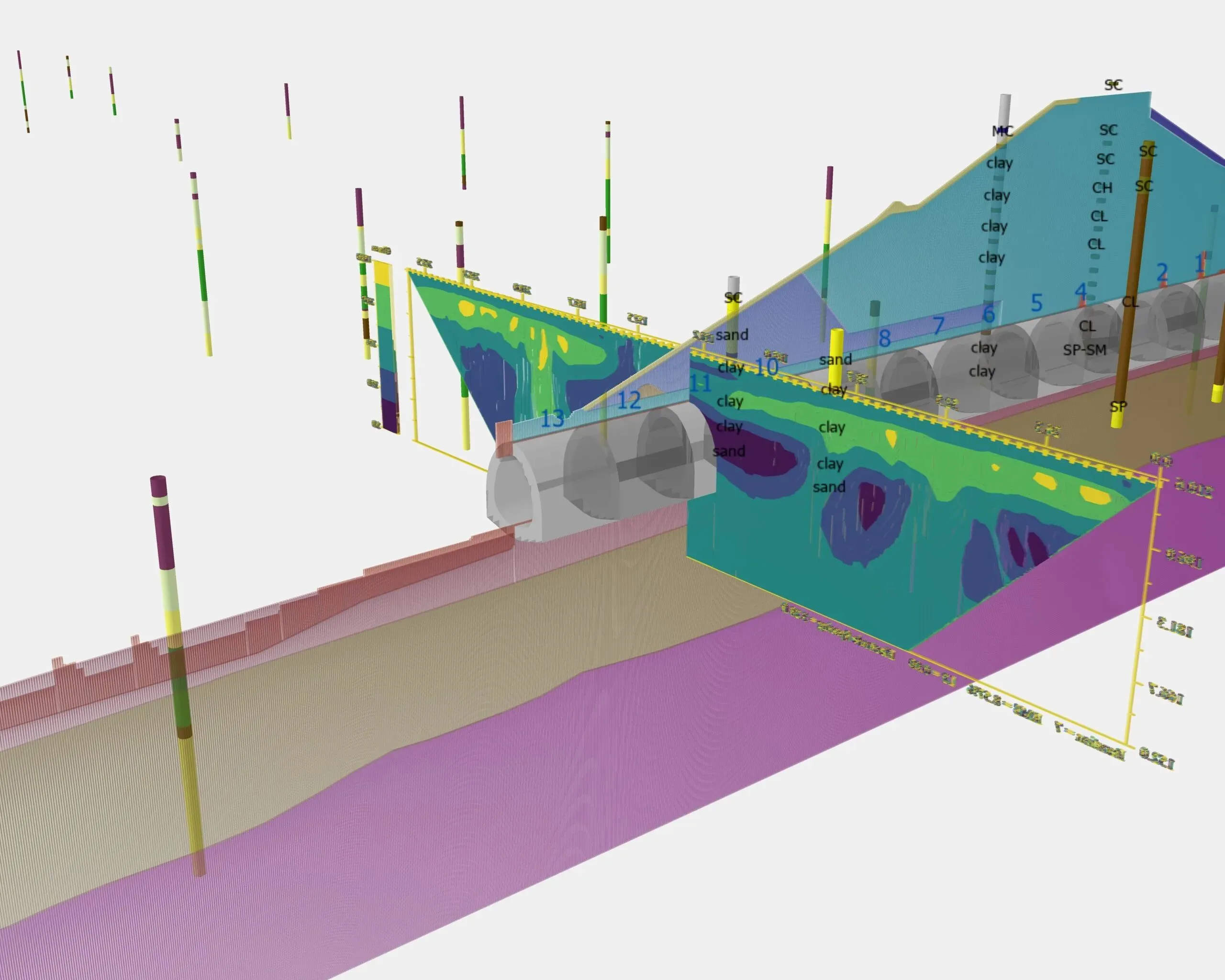
Red Rock Dam project site using modern data collection methods displayed using Leapfrog Works and OpenGround
Louisiana DOTD
The Department of Transportation and Development in Louisiana (DOTD) manages and develops critical highways; bridges; and airport, port, rail and waterway infrastructure. As a result of this expansive responsibility, and the geological and climate challenges across the state, its activities face significant financial requirements.
To mitigate this, DOTD took steps to simplify geotechnical data collection as it set about putting 2,500 projects worth of data onto the cloud to provide better and more easily used information for engineers.
DOTD senior geotechnical research engineer Gavin Gautreau explains: “We needed long-term insight into Louisiana’s soil conditions. Soil investigations can be expensive, so preserving that data was our first step. Capitalising on that data can be our next step.”
The savings involved are not hypothetical. DOTD transitioned to using OpenGround, which allows calculations and visualisations to be generated within minutes of receiving data files. And importantly, its storage of data on the cloud saves future costs.
DOTD assistant geotechnical engineer administrator Jesse Rauser says: “We need to start thinking of data as an asset rather than something to be stored or archived. Also, we want to encourage engineers to start the data management process early and eliminate paper forms. Some people think that the paper log is still very important, but they’re not the ones doing the design.”
Rauser points out that it costs approximately $15,000 [£11,200] per soil boring. This means that preserving the data from these borings eliminates significant cost in the future, as it can be drawn upon years later to negate the need to revisit the site and drill additional holes.
DOTD also simplified the data collection process for this work. “Our simple boring request form easily saves 30 minutes to an hour on every single project and the tools we’ve built to visualise data and for statistical analysis save at least an hour per project,’ says Rauser.
“Without a doubt, we’re achieving substantial time savings across our projects simply by having well-organised and accessible data.”

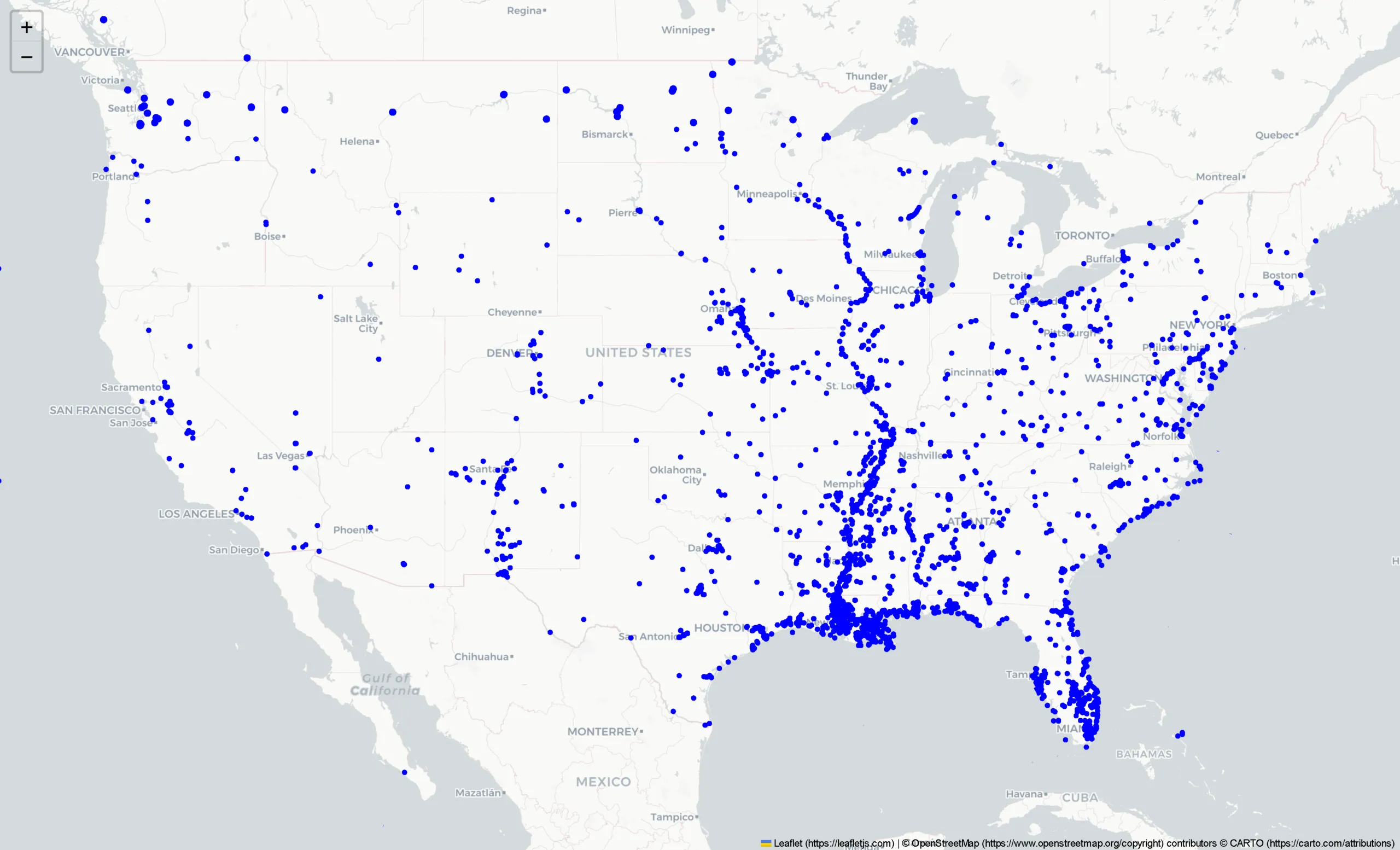
USACE map of approximately 8500 existing projects in 200,000 locations with more than 8M.ft (2.4M.m) of drilling
Value matters
At its heart, enabling engineers to be more productive and to do more engineering will enable industry to deliver more. But it can create verifiable value for engineering too. The US Army Corp of Engineers (USACE) has seen notable outcomes from its work to move subsurface data to the cloud.
For decades, USACE gathered subsurface data essential to its operation across the country and beyond. This amounted to millions of linear metres, across thousands of projects like dams, levees, buildings and bridges.
The incremental collection of this data over time meant that the data was held across more than 500 separate and disparate database systems until USACE made the decision to introduce a global standard for its subsurface geotechnical data with OpenGround at the heart of its cloud-based system.
To do this, USACE worked with Dataforensics to start the process. Dataforensics president Scott Deaton notes that this was not without its complexities.
“We compiled over 8,000 different project files. We had to clean the data, standardise it, organise it and migrate it into OpenGround. We started out doing this manually, but after realising how long it took us to do the first 100, we had to look at how we could use the OpenGround API to automate the process.”
Developing a software option to achieve that aim enabled the team to speed up data migration by potentially decades, with complete data migration undertaken in just two years, saving an over 50,000 work-hours from an estimated 62,700 work-hours.
The outcomes from this were significant. USACE has seen a dramatic improvement in interoperability, thanks to data being more easily integrated into other software systems such as Leapfrog Works and GeoStudio. That in turn has allowed new borehole information to be imported into the same platform as geophysical data, which has enabled engineers to visualise data sets together – improving the ease with which they can plan and make decisions.
No less importantly, the resulting single point of truth that this subsurface data asset has become represents a major financial asset for USACE.
Deaton explains, “That’s a half-a-million dollars investment to get the data migrated and it created an asset worth over half-a-billion dollars.”
This means that technology, when applied well to engineering data, not just design, can both reduce complications in sharing information on a single project and realise greater financial value from the work and data that engineering companies already do and hold.
Central to all of this, however, was that both Louisiana DOTD and the USACE found ways to achieve this from historic data sources and practices without unduly onerous impacts on engineers. That’s something that may need to be replicated widely as artificial intelligence begins to emerge as a further benefit to such data assets.
Seequent civil segment director Pat McLarin explains: “The value of this can be achieved at different scales, large and small. Engineering consultancies already know that their project data is their intellectual property and holds value for future projects and bidding. We help to systemise that data and that is becoming even more vital now that AI is emerging and can deliver a step change in productivity beyond the 20-30% gains we see already.”
eBook: Switching to cloud-based management

In association with
Like what you’ve read? To receive New Civil Engineer’s daily and weekly newsletters click here.


