Skip to content
A4 civilengineering
  • Home
  • About Us
  • Education
  • Community
  • Thought
  • Ongoing Happenings
  • Contact Us
Menu Close

Blog

Home » Ongoing Happenings » City tests out device to map road conditions, assess potholes at Hope Cemetery
City tests out device to map road conditions, assess potholes at Hope Cemetery
WORCESTER — A system that uses remote sensing technology to help municipalities map out infrastructure issues is being tested on the roads of Hope Cemetery.

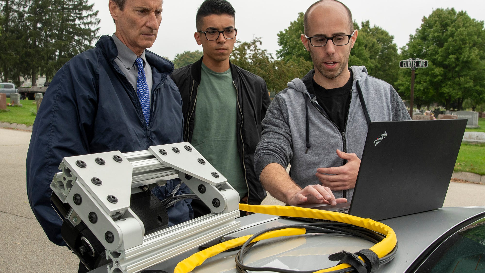
Roadgnar, a company founded by a group of Worcester Polytechnic Institute graduates that focuses in helping municipalities use data collection to improve their infrastructure, is testing the beta version device that they hope will help the city map out and monitor infrastructure conditions for assets such as pavements and sidewalks in real time.

The device uses various sensors to collect data including light detection and ranging (LiDAR) technology. After being attached to a vehicle through a magnet and charged with power from the vehicle, the device captures the physical environment that the vehicle drives around and relays conditions on a 3D map.
Read More
www.telegram.com

Read more articles

Previous PostShadow operators selected for new Greater Paris driverless metro lines
Next PostExpo 2020 Dubai: How RTA will prevent traffic jams around the site

You Might Also Like

Read more about the article Bird launches multimodal fleet in Rome

Bird launches multimodal fleet in Rome

January 24, 2022
Read more about the article Bird extends accessibility programme to San Diego and San Francisco

Bird extends accessibility programme to San Diego and San Francisco

January 1, 2022
Read more about the article New York’s Second Avenue Subway expansion moves to engineering phase

New York’s Second Avenue Subway expansion moves to engineering phase

January 24, 2022

Archives

  • March 2022
  • February 2022
  • January 2022
  • December 2021
  • November 2021
  • October 2021
  • September 2021
  • August 2021
  • July 2021

Categories

  • 3D Printing
  • Air Quality
  • Architecture
  • Automation
  • BIM
  • Civil Software
  • Computer Vision
  • Constrcution Site
  • Digital Twin
  • Disaster
  • Earthquake
  • Edu Resource
  • Environmental
  • FreeCourse
  • Geotechnical Engineering
  • GIS
  • Industry News
  • Intelligent Transportation System
  • IOT
  • Market Analysis
  • Project Management
  • Remote Sensing
  • Sensors
  • Smart City
  • Smart Home
  • Smart Home/Building
  • Smart Materials
  • Structural Engineering
  • Structural Health Monitoring
  • Transportation
  • Uncategorized
  • Urban Planning

Recent Posts

  • Kontrol Technologies is in the thick of the commercial building upgrade supercycle
  • I-Bhd, China Mobile team up to build Malaysia’s first green smart building
  • FedEx launches AI-powered sorting robot to drive smart logistics
  • 8 trends shaping cities in 2022
  • DC joins growing list of cities requiring new buildings to include EV parking
A4 civilengineering
©2021 Privacy policy
  • Home
  • About Us
  • Education
  • Community
  • Thought
  • Ongoing Happenings
  • Contact Us

Enjoying the contents?

Subscribe to our weekly newsletter