
ITS Equant consortium completes successful satellite connectivity traffic management test | Traffic Technology Today
The ITS Equant consortium, which aims to use satellite systems to support safer roads, has successful completed a factory acceptance test at Westcott Venture Park in the UK.
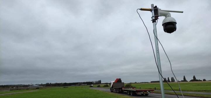
With the use of Valerann’s solar-powered IoT sensors, and cameras provided by Excelerate, ITS Equant successfully ingested data collected from the road, and linked through a satellite connection into Valerann’s cloud-based Real Time Fusion Engine to enable event detection and vehicle tracking, including wrong way driving, stopped vehicles, slow moving vehicles and speeding.
The Real Time Fusion Engine leverages machine vision and data fusion algorithms allowing access to real time traffic insights.
Valerann co-founder and CEO, Gabriel Jacobson, said, “This trial successfully showcases that satellite connectivity can be utilized to provide effective road and traffic management by covering areas on the road which are not easily accessible by current communication networks.”
The ITS Equant consortium was formed by Valerann, an intelligent transportation systems (ITS) SaaS company, which provides virtual traffic monitoring systems for road operators, and Excelerate Technology, a UK-based technology and connectivity partner, delivering hybrid connectivity solutions globally across diverse markets including emergency services, public safety, healthcare, governments, transport, and utilities.
The consortium is funded by the European Space Agency, through its Programme Space Solutions, and supported by the Satellite Applications Catapult.
The factory acceptance test represents a significant milestone in a year-long project which will lead to a pilot installation of satellite connected cameras linked to Valerann’s intelligent traffic management platform. The system will provide up to 100% full visibility in real time to a UK operational control center, improving safety and traffic flow whilst reducing carbon emissions.
Bethan Evans, operations director for Excelerate Technology, added, “We have been working on this project with Valerann and Satellite Applications Catapult for over a year now. And this major milestone clearly demonstrates that by working together we have been able to prove how all areas with connectivity challenges can benefit from technologies to improve road and traffic management.”
www.traffictechnologytoday.com


