
Remote sensing of forest could reduce severity of forest fires
Dr. Jonathan Greenberg and his lab research the forest floor before and after wildfires to better understand and communicate the ways in which fires move, aiding land managers and forest fires in their fight against catastrophe.
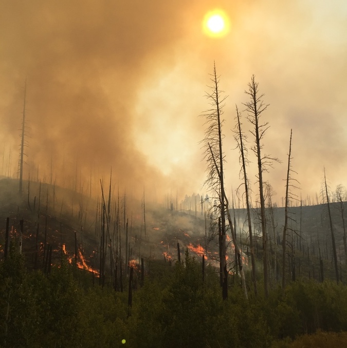
Gigafire, a fire that burns more than one million acres, was a word that had not been used in California before 2020. That changed with the August Complex Fire that burned over one million acres in 2020. Not all fires are bad – we can’t and shouldn’t want to put all of them out – but lessening the severity of wildfires through enhanced ground and resource management is critical. That’s where Dr. Jonathan Greenberg and his team are making a difference with their research and collaboration with the U.S. Forest Service, CalFire, and the California Air Resources Board.
Dr. Jonathan Greenberg runs the University’s Global Environmental Analysis and Remote Sensing lab that is helping to transform the understanding of forest ground coverage with their research using LiDAR technology. LiDAR stands for Light Detecting And Ranging and is a remote sensing method used to examine the three dimensional structure of vegetation. The lab’s goal is to understand the distribution and changes in vegetation over large landscapes using remote sensing technology, ultimately to understand where and why things are distributed the way they are, and to provide this data to land and resource managers.
The lab uses both airborne and terrestrial LiDAR to quantify the first two meters of the forest’s understory as that is the most crucial to predicting how a fire will move. Using this same scanned information, the lab also analyzes the amount of carbon in the trees before and after a fire. Carbon burned during fires goes into the air and contributes to climate change.
Before implementing LiDAR technology to map forests before and after fires, the only way to figure out how much ground cover was in a certain area was to deploy teams into the field – an expensive and time-consuming endeavor. However, with LiDAR the lab can figure out down to the branch what burned and what didn’t during a fire, helping them to better understand the ways in which fires move, and the best ways in which to reduce the chances of extremely severe forest fires.
“Analyzing the amount and location of fuels loss allows us to understand the situations in which you go from low intensity ground fires, which admittedly still causes problems, to when a fire spreads into the crown. Crown fires are the real danger – those are the wildfires where things blow up.” Says Dr. Greenberg. “Our department contributes to the science behind fuels management. When a fire does break out, and they will break out, you want to have already managed the fuels to minimize the risk of catastrophic wildfires.” Through their research, they work with land and resource managers who can target specific areas that need treatment (removal of fuels, collection of material for pulp, and controlled burns) and they work with modelers to understand the movement of fires.
www.unr.edu


