
Startup Cognitive Space using artificial intelligence to manage satellite operations – SpaceNews
The company closed a $4 million seed funding round and won a $1.7 million Space Force contract to prototype a hybrid architecture of imaging satellites
WASHINGTON — Cognitive Space raised $4 million in seed funding for its artificial intelligence-based software designed to manage imaging satellite constellations, the company’s chief executive said.
The funding round for the Houston-based startup was led by Grit Ventures with participation from Argon Ventures, Techstars, SpaceFund and other firms.
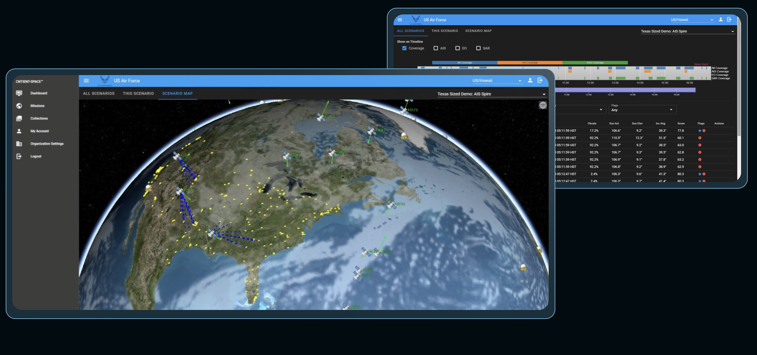
CEO Scott Herman said the company’s software tools are being used by U.S. national security agencies to prototype concepts such as how data could be collected from hybrid architectures of government and commercial imagery satellites.
Cognitive Space also has secured undisclosed commercial customers that operate remote sensing constellations, Herman said.
The company won a $1.7 million contract in August at a Space Force Pitch Day event. “We are helping them with concept development for the hybrid space architecture, and also helping them understand how they can take advantage of emerging commercial capabilities,” said Herman. Cognitive Space was selected this fall for the National Geospatial Intelligence Agency startup accelerator.
In a recent experiment with military and intelligence agencies, the company’s software was used to orchestrate data collection across more than 400 satellites from more than 12 different suppliers, he said.
Herman, a former BlackSky and DigitalGlobe executive, said these collection management tools could be game changers for government agencies that traditionally have worked with only a small number of commercial satellite imagery providers. “This is a very different way to think about how the government’s going to be able to take advantage of all these emerging commercial capabilities,” he said. “The U.S. government has to figure out how they’re going to interact with new types of capabilities. So we’re helping with some of that prototyping process.”
Cognitive Space also is looking to attract customers from the commercial Earth observation sector that are planning future constellations or looking for ways to better monetize their satellites.
“Building out the required ‘ground architecture’ is a major hurdle for new space companies,” said Herman. AI tools can help them decide where to deploy their satellites to maximize revenue and how to manage data collection once satellites are in orbit.
WASHINGTON — Cognitive Space raised $4 million in seed funding for its artificial intelligence-based software designed to manage imaging satellite constellations, the company’s chief executive said.
The funding round for the Houston-based startup was led by Grit Ventures with participation from Argon Ventures, Techstars, SpaceFund and other firms.
CEO Scott Herman said the company’s software tools are being used by U.S. national security agencies to prototype concepts such as how data could be collected from hybrid architectures of government and commercial imagery satellites.
Cognitive Space also has secured undisclosed commercial customers that operate remote sensing constellations, Herman said.
The company won a $1.7 million contract in August at a Space Force Pitch Day event. “We are helping them with concept development for the hybrid space architecture, and also helping them understand how they can take advantage of emerging commercial capabilities,” said Herman. Cognitive Space was selected this fall for the National Geospatial Intelligence Agency startup accelerator.
In a recent experiment with military and intelligence agencies, the company’s software was used to orchestrate data collection across more than 400 satellites from more than 12 different suppliers, he said.
Herman, a former BlackSky and DigitalGlobe executive, said these collection management tools could be game changers for government agencies that traditionally have worked with only a small number of commercial satellite imagery providers. “This is a very different way to think about how the government’s going to be able to take advantage of all these emerging commercial capabilities,” he said. “The U.S. government has to figure out how they’re going to interact with new types of capabilities. So we’re helping with some of that prototyping process.”
Cognitive Space also is looking to attract customers from the commercial Earth observation sector that are planning future constellations or looking for ways to better monetize their satellites.
“Building out the required ‘ground architecture’ is a major hurdle for new space companies,” said Herman. AI tools can help them decide where to deploy their satellites to maximize revenue and how to manage data collection once satellites are in orbit.
spacenews.com


