Lockheed Develops Hybrid Antenna For 5G, Radar & Remote Sensing Applications
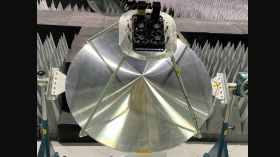
Lockheed Martin has invented a new type of satellite dish technology with a wide range of use on satellites and ground terminals, including space-based 5G. The Wide Angle ESA Fed Reflector (WAEFR) antenna is a hybrid of a phased array Electronically Steerable Antenna (ESA) and a parabolic dish and increases coverage area by 190% compared to traditional phased array antennas at a much lower cost.
This antenna is part of a larger research and development investment in 5G.MIL technologies that will optimize and securely connect warfighting platforms to enable joint all-domain command and control (JADC2).
The team rapidly prototyped, tested and validated this system in a matter of months compared to what previously took years. WAEFR also features:
High performance gain of a dish with the beam agility of an ESA
Low Size Weight and Power (SWAP) common product solution to accommodate any orbital altitude or ground terminal application
Advances in 3D-printing technology and accelerated parts production
This type of antenna will also benefit the broader communications and ISR communities by providing a more reliable scanning solution compared to gimbaled designs.
This antenna is part of a larger research and development investment in 5G.MIL technologies that will optimize and securely connect warfighting platforms to enable joint all-domain command and control (JADC2).
The team rapidly prototyped, tested and validated this system in a matter of months compared to what previously took years. WAEFR also features:
High performance gain of a dish with the beam agility of an ESA
Low Size Weight and Power (SWAP) common product solution to accommodate any orbital altitude or ground terminal application
Advances in 3D-printing technology and accelerated parts production
This type of antenna will also benefit the broader communications and ISR communities by providing a more reliable scanning solution compared to gimbaled designs.
www.mbtmag.com