Remote sensing applied to monitor erosion in Mekong Delta
A delegation of the Ministry of Natural Resources and Environment (MoNRE) led by Deputy Minister Tran Quy Kien on December 13 made an inspection tour of a sub-project on monitoring riverbank and coastal erosion in Mekong Delta using remote sensing.
Hanoi (VNA) – A delegation of the Ministry of Natural Resources and Environment (MoNRE) led by Deputy Minister Tran Quy Kien on December 13 made an inspection tour of a sub-project on monitoring riverbank and coastal erosion in Mekong Delta using remote sensing.
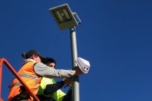
During the field trip, they inspected the installation and training on a system which obtain signal of SPOT 6 and 7 satellites.
The system is built at the headquarters of the Central Remote Sensing Station of the MoNRE’s Department of National Remote Sensing.
It aims to form a database on changes of riverbanks and coastal line in the Mekong Delta, using remote sensing so as to assess efficiency of counter-erosion measures, as well as support regional development planning, thereby taking the initiative in preparedness, adaptation and mitigation of losses caused by erosion amid climate change.
The sub-project’s long-term objective is to update multi-temporal information on riverbank and coastal changes in Mekong Delta using remote sensing.
During the inspection, Kien highly valued efforts made by the managing board, the Department of National Remote Sensing and relevant units in the implementation of the sub-project, urging them to ensure progress, quality and targets of remaining tasks.
Hanoi (VNA) – A delegation of the Ministry of Natural Resources and Environment (MoNRE) led by Deputy Minister Tran Quy Kien on December 13 made an inspection tour of a sub-project on monitoring riverbank and coastal erosion in Mekong Delta using remote sensing.
During the field trip, they inspected the installation and training on a system which obtain signal of SPOT 6 and 7 satellites.
The system is built at the headquarters of the Central Remote Sensing Station of the MoNRE’s Department of National Remote Sensing.
It aims to form a database on changes of riverbanks and coastal line in the Mekong Delta, using remote sensing so as to assess efficiency of counter-erosion measures, as well as support regional development planning, thereby taking the initiative in preparedness, adaptation and mitigation of losses caused by erosion amid climate change.
The sub-project’s long-term objective is to update multi-temporal information on riverbank and coastal changes in Mekong Delta using remote sensing.
During the inspection, Kien highly valued efforts made by the managing board, the Department of National Remote Sensing and relevant units in the implementation of the sub-project, urging them to ensure progress, quality and targets of remaining tasks.
en.vietnamplus.vn