
Remote Sensing Could Predict Well Water Quality After Floods – Eos
After a flood, most people rely on officials to test public water sources. Private well owners are on their own, with little data to guide testing and treatment. New research seeks to change that.
More than 13 million U.S. households rely on private wells for their water supply. Unlike municipal water systems, which officials test and treat for contaminants, each well owner is responsible for their own water quality. There are no federal regulations and few, if any, state regulations governing private well water quality, even after water-contaminating floods.
Floods can pollute drinking water sources with fecal matter and other health hazards, and a study of private systems (mainly wells) in Virginia found that about 58% of more than 2,000 samples violated at least one standard required for municipal water systems. Yet there are few data to inform well owners when or whether testing is important after a flood.
Scientists from Northeastern University are devising a new approach to collecting detailed data about well users and their flood and health risks and will present their work on 16 December at AGU’s Fall Meeting 2021.
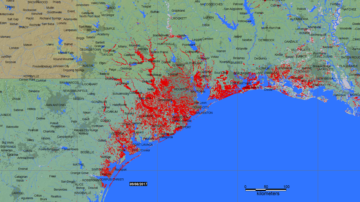
“What we’ve been concerned about is after a natural disaster, if there’s a big flooding event, what actually happens to these systems,” said Kelsey Pieper, an assistant professor in the Department of Civil and Environmental Engineering at Northeastern. “Do we even need to worry about private wells after flooding events, or are they fine?” Pieper and her team are combining remote sensing data, census demographics, flood hazard maps, and well water sampling data to answer that question and better inform disaster recovery efforts.
More than 13 million U.S. households rely on private wells for their water supply. Unlike municipal water systems, which officials test and treat for contaminants, each well owner is responsible for their own water quality. There are no federal regulations and few, if any, state regulations governing private well water quality, even after water-contaminating floods.
Floods can pollute drinking water sources with fecal matter and other health hazards, and a study of private systems (mainly wells) in Virginia found that about 58% of more than 2,000 samples violated at least one standard required for municipal water systems. Yet there are few data to inform well owners when or whether testing is important after a flood.
Scientists from Northeastern University are devising a new approach to collecting detailed data about well users and their flood and health risks and will present their work on 16 December at AGU’s Fall Meeting 2021.
“What we’ve been concerned about is after a natural disaster, if there’s a big flooding event, what actually happens to these systems,” said Kelsey Pieper, an assistant professor in the Department of Civil and Environmental Engineering at Northeastern. “Do we even need to worry about private wells after flooding events, or are they fine?” Pieper and her team are combining remote sensing data, census demographics, flood hazard maps, and well water sampling data to answer that question and better inform disaster recovery efforts.
eos.org


