Earth Observatory of Singapore – Remote Sensing Lab
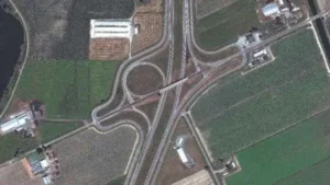
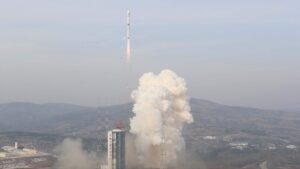
We support stakeholders and decision-makers by monitoring and mapping hazards and disasters, environmental crises, sea-level rise, and climate change using cutting-edge technology in remote sensing (e.g. SAR, LiDAR, optical). We will drive scientific innovation and improved understanding of hazards through the development of new algorithms and systems and through symbiotic collaboration with global partners.
Latest Publications
Stephenson, Oliver L., Tobias Köhne, Eric Zhan, Brent E. Cahill, Sang-Ho Yun, Zachary E. Ross, and Mark Simons. “Deep Learning-Based Damage Mapping With InSAR Coherence Time Series.” IEEE Transactions on Geoscience and Remote Sensing (2021): 1-17.
Tay, Cheryl W. J., Sang-Ho Yun, Shi Tong Chin, Alok Bhardwaj, Jungkyo Jung, and Emma M. Hill. “Rapid flood and damage mapping using synthetic aperture radar in response to Typhoon Hagibis, Japan.” Scientific Data 7, no. 1 (2020).
Salman, Rino, Eric O. Lindsey, Karen H. Lythgoe, Kyle E. Bradley, Muzli Muzli, Sang-Ho Yun, Shi Tong Chin, Cheryl W. J. Tay, Fidel Costa, Shengji Wei et al. “Cascading Partial Rupture of the Flores Thrust during the 2018 Lombok Earthquake Sequence, Indonesia.” Seismological Research Letters (2020).
Loos, Sabine, David Lallemant, Jack Baker, Jamie W. McCaughey, Sang-Ho Yun, Nama Budhathoki, Feroz Khan, and Ritika Singh. “G-DIF: A geospatial data integration framework to rapidly estimate post-earthquake damage.” Earthquake Spectra (2020).
Latest Publications
Stephenson, Oliver L., Tobias Köhne, Eric Zhan, Brent E. Cahill, Sang-Ho Yun, Zachary E. Ross, and Mark Simons. “Deep Learning-Based Damage Mapping With InSAR Coherence Time Series.” IEEE Transactions on Geoscience and Remote Sensing (2021): 1-17.
Tay, Cheryl W. J., Sang-Ho Yun, Shi Tong Chin, Alok Bhardwaj, Jungkyo Jung, and Emma M. Hill. “Rapid flood and damage mapping using synthetic aperture radar in response to Typhoon Hagibis, Japan.” Scientific Data 7, no. 1 (2020).
Salman, Rino, Eric O. Lindsey, Karen H. Lythgoe, Kyle E. Bradley, Muzli Muzli, Sang-Ho Yun, Shi Tong Chin, Cheryl W. J. Tay, Fidel Costa, Shengji Wei et al. “Cascading Partial Rupture of the Flores Thrust during the 2018 Lombok Earthquake Sequence, Indonesia.” Seismological Research Letters (2020).
Loos, Sabine, David Lallemant, Jack Baker, Jamie W. McCaughey, Sang-Ho Yun, Nama Budhathoki, Feroz Khan, and Ritika Singh. “G-DIF: A geospatial data integration framework to rapidly estimate post-earthquake damage.” Earthquake Spectra (2020).
earthobservatory.sg